001 / BC · Ag · Pb · Zn ± Au
Texas Property
Historic Beaverdell silver-lead-zinc camp, west slope of Wallace Mountain, south-central British Columbia · 60 km SE of Kelowna, 3 km W of Beaverdell. Vein-style polymetallic targets in Westkettle batholith granodiorite.
Optioned from Troubadour Resources Inc.; closed June 18, 2025. Consideration: 1,600,000 common shares (no cash) plus staged work commitments of C$150,000 on or before the second anniversary of June 17, 2025, and an additional C$350,000 on or before the fourth anniversary of June 17, 2025. Shares issued to Troubadour are subject to a four-month statutory hold.
A1 / CONTEXT
Historic Beaverdell Silver-Lead-Zinc Camp, South-Central BC.
The Texas Property sits in the Beaverdell Mining Camp on the west slope of Wallace Mountain in south-central British Columbia, Greenwood Mining Division. The camp has a recorded production history spanning nearly a century, with the past-producing Highland Bell mine operating near-continuously from 1913 to 1991.
A2 / HOST ROCKS
The dominant host in the Beaverdell camp is Jurassic Westkettle batholith granodiorite, intruded by Eocene quartz monzonite porphyry stocks including the Beaverdell stock. Locally, mineralization extends into metamorphosed Wallace Formation rocks. Mineralization in the camp has been radiometrically dated at approximately 50 Ma (galena Pb-Pb), coeval with the emplacement of the Eocene quartz monzonite stocks.
A3 / DEPOSIT MODEL
The Beaverdell camp hosts polymetallic Ag-Pb-Zn ± Au vein mineralization (MINFILE deposit type I05), characterized by brecciated quartz-vein systems within an approximately 6.4 km east-west zone, faulted and offset along secondary structures. Primary ore mineralogy comprises galena, native silver, and pyrrhotite, accompanied by sphalerite, pyrite, arsenopyrite, tetrahedrite, and chalcopyrite, in a quartz-calcite-fluorite gangue.
The targeting model on the Texas claim package focuses on identifying and ranking vein-style polymetallic targets within the granodiorite host, with emphasis on the brecciated quartz vein system and its offset and faulted segments. Work to date is at the target-generation stage.
A4 / WORK HISTORY & 2021 DRILLING
Fifty Years of Workings, One Modern Drill Program.
Exploration on the Texas ground dates to the early 1970s, when trenching at the Doorn showing on Logan Creek exposed shear-hosted quartz–chalcopyrite–pyrite veins. In 1975, Argentia Mines Ltd. sampled the T1 trench and reported 5.83 oz/ton Au, 29.1 oz/ton Ag and 1.57% Cu over 12 inches. Later operators added adits, trenches, soil grids, VLF and magnetic surveys, and small drill programs across nine documented showings.
Between 2020 and 2022, vendor Troubadour Resources completed rock and soil sampling (including 559 soil samples on 50 m-spaced lines), ground magnetic surveys and a 25-hole, 2,092.8 m HQ diamond drill program designed to test magnetic lows at the Doorn and Cabin targets. The 2022 program at Doorn South, Midnight and Bug outlined magnetic lows coinciding with polymetallic soil anomalies that remain open.
- 2021 drilling
- 25 holes · 2,092.8 mHQ core at the Doorn, Logan Creek and Cabin targets
- Best intercept · Cabin · TX21-018
- 5.7 m @ 1.78 g/t Auand 0.18% Zn, including 0.9 m @ 9.133 g/t Au and 25.7 g/t Ag
- Doorn target
- 1.5 m @ 1.796 g/t Auand 20.4 g/t Ag; also 0.3 m @ 2.764 g/t Au and 58.2 g/t Ag
- Second Cabin hole
- 0.8 m @ 8.79 g/t Auand 0.35 m @ 5.34 g/t Au
Historical results reported by Troubadour Resources Inc. (ARIS 40128; summarized in the 2024 technical report). Intervals are core lengths; true widths are not known. The Company has not completed drilling on the Property, and its qualified person has not independently verified this historical information.
A5 / MINERAL OCCURRENCES
Nine Documented Showings.
Quartz ± sulphide ± carbonate veins up to two metres thick have been identified across the Property, hosted almost exclusively in Nelson Plutonic Suite granodiorite, with visible gold reported in multiple veins. Maximum values reported for each occurrence:
| Showing | Sample type | Au g/t | Ag g/t | Cu % | Pb % | Zn % | Mo % |
|---|---|---|---|---|---|---|---|
| Doorn | Trench / drilling | 373.7 | 997.7 | 3.14 | – | – | – |
| Cabin | Grab | 18.95 | 50.5 | 0.08 | 1.35 | 0.18 | – |
| Wombat | Trench | 125.5 | 49.9 | 11 | – | 0.06 | – |
| Bug | Drilling | – | 541.7 | – | 1.52 | 0.54 | – |
| Cranberry | Historic grab | 31.5 | 17.8 | – | – | – | – |
| Boston | Trench | – | 76 | – | – | – | >0.1 |
| Midnight | Not specified | 0.203 | 332 | – | 1.1 | – | – |
| Inyo-Ackworth | Shear zone (grab) | 6.72 | 509 | – | 7.38 | – | – |
Source: Table 11, 2024 technical report. Maximum values only; no consideration is given to vein thickness or sample size. Grab, trench and historical samples are selective by nature and are not necessarily representative of mineralization on the Property.
A6 / TWO DEPOSIT MODELS
Polymetallic veins (I05). Mineralized veins trend west-northwest to east-southeast and dip steeply south, with an assemblage of sphalerite, galena and pyrite plus subordinate chalcopyrite and arsenopyrite in chlorite-carbonate-clay-silica alteration halos. The orientation, mineralogy and alteration closely resemble the Lass vein system at the Highland Bell mines on Wallace Mountain, immediately east. The report also identifies a second, north-south structural set, possibly related to Eocene extension, that has received little historical attention.
Porphyry Mo, low-F type (L05). Widespread anomalous molybdenum and mapped Coryell Intrusive Suite stocks, including the Eugene Creek Stock, are interpreted to indicate potential for porphyry molybdenum mineralization similar to the nearby Tuzo Creek prospect south of the Property.
A7 / FIELD PHOTOGRAPHS
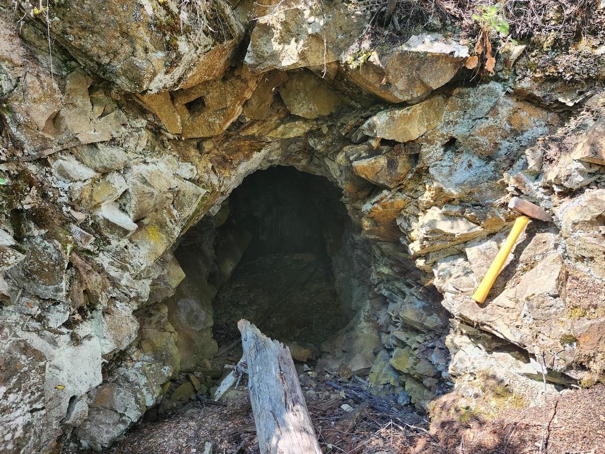
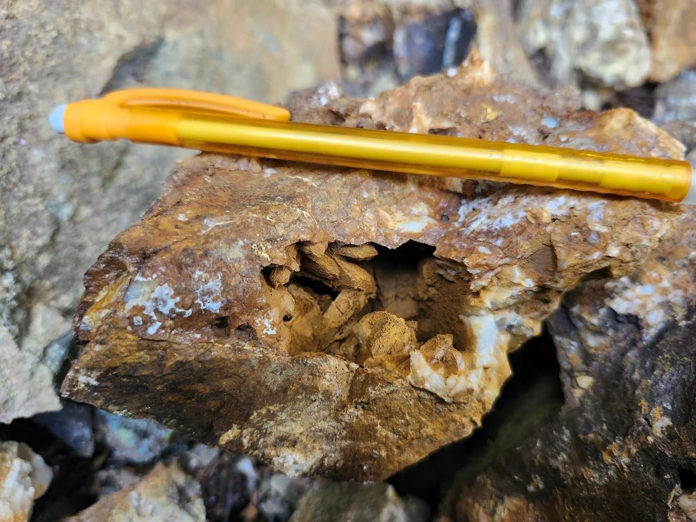
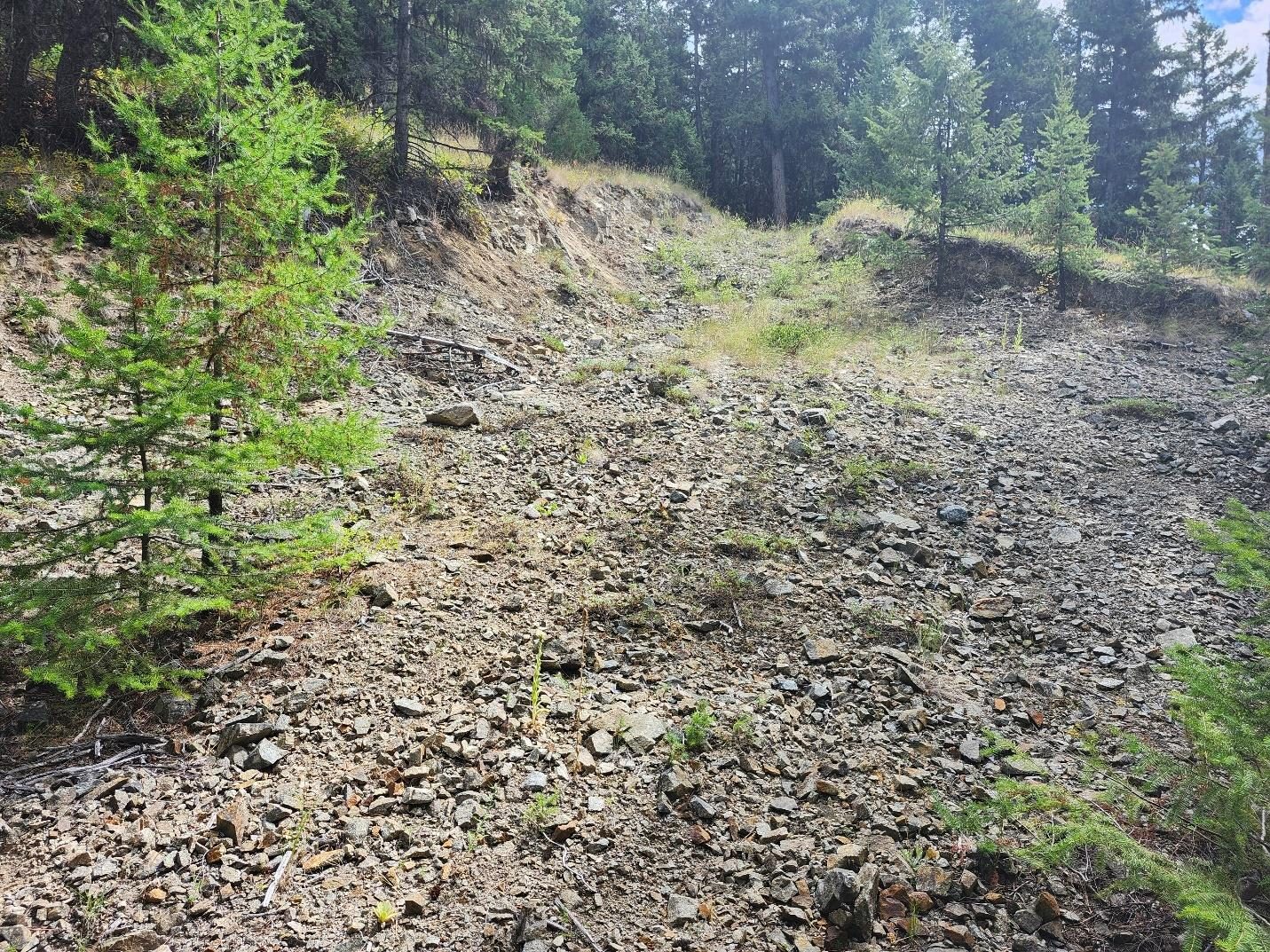
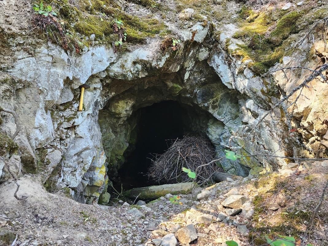
Photographs: R.T. Walker, P.Geo., due-diligence property visit, August 14 and 20, 2024 (2024 technical report).
A8 / TECHNICAL REPORT & RECOMMENDED PROGRAM
An NI 43-101 technical report on the Texas Property, dated November 1, 2024, was prepared by Richard T. Walker, P.Geo. (Dynamic Exploration Ltd.) for Troubadour Resources Inc. It concludes that further work is strongly recommended and sets out a three-phase program.
- Phase I · compilation & targeting
- C$32,500GIS compilation of historical soil, rock, structural and geophysical data; additional tenure
- Phase II · field
- C$90,000Mapping and sampling (including the Eugene Creek Stock), soil, VLF and self-potential surveys
- Phase III · drilling
- C$1,000,000Approximately 5,000 m, including Doorn, Cabin and deeper tests of stacked vein sets
- Total recommended
- C$1,122,500Phase III is dependent on Phase I and II results
The program and budget are recommendations of the report’s author and are not a Company commitment or announced budget. The report was prepared for the vendor, Troubadour Resources Inc., prior to the Company’s option.
Adjacent properties. The Texas Property is located in close proximity to the past-producing Highland Bell (Beaverdell) mine, which operated from 1913 to 1991 and reportedly produced approximately 1,076 million grams of silver, 520,197 grams of gold, 11.6 million kilograms of lead, 13.9 million kilograms of zinc, and 58,171 kilograms of cadmium from approximately 1.2 million tonnes of ore. The Highland Bell production data is from a separate, past-producing mine on adjacent ground within the same camp and is provided for geological context only. Mineralization on adjacent or nearby properties (including the Highland Bell mine) is not necessarily indicative of mineralization on Molten Metals' Texas Property.
Qualified Person. The technical content on this page has been reviewed and approved by Deepak Varshney, P.Geo., a qualified person under National Instrument 43-101. No NI 43-101 mineral resource estimate has been prepared on the property.
Forward-Looking Information. This page contains forward-looking information within the meaning of applicable Canadian securities legislation, including statements regarding exploration plans, targeting models, and corporate work programs. Forward-looking information speaks only as of the date hereof and the Company disclaims any obligation to update it except as required by law.
Adjacent / Neighbouring Properties. References to nearby mines, deposits, showings, drill results, or production figures on properties not held by Molten Metals Corp. are provided for geological and jurisdictional context only. Mineralization on adjacent or nearby properties is not necessarily indicative of mineralization on Molten Metals Corp.'s properties. The Qualified Person has not verified the information disclosed by the holders of those properties.
Mineral Resources. No mineral resource or mineral reserve has been defined on this Property under NI 43-101 — Standards of Disclosure for Mineral Projects. There is no guarantee that further exploration will result in the determination of a mineral resource. Mineral exploration is inherently speculative and involves significant risk.
Qualified Person. The scientific and technical information on this page has been reviewed and approved by Deepak Varshney, P.Geo., a Qualified Person as defined under National Instrument 43-101.